City and Context
A more detailed review of growth patterns and historical catalysts, a look at the role of the city within the region, a breakdown of subareas, etc.
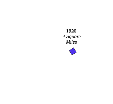
Before the 1950’s, Huntsville’s land area was roughly 4 square miles centered on the courthouse square. The area was primarily an agrarian center. Cotton dominated the agricultural market and the City became home to several cotton textile mills. Residential development formed neighborhoods around the mills which are still in existence today.
The United States Army selected Huntsville as its rocket and missile development center during the 50’s and became what is known as Redstone Arsenal (RSA) today. RSA is the most notable catalyst for Huntsville’s growth. Both population and the amount of land within the city limits skyrocketed with the help of Wernher von Braun and his team of German scientists and engineers developing the Redstone Rocket.
By the end of the 50’s, Huntsville was known worldwide as a major center for high technology. Redstone’s Army Ballistic Missile Agency (ABMA) put Huntsville on the national stage by placing America’s first satellite, Explorer 1, into orbit. ABMA formed today’s NASA/Marshall Space Flight Center in 1960, providing economic growth for Huntsville and the entire North Alabama Region.
Huntsville was on the move, from 4 square miles in 1950 to around 50 square miles in 1960.
Huntsville’s city limits have grown over the past 100 years, from 4 square miles centered around the Courthouse Square in 1920 to the country’s 28th largest city by land area. (City Limits data credit: City of Huntsville, GIS Division)
With the development of Marshall Space Flight Center, Huntsville’s population and land area continued to grow during the 60’s. Over 12,000 acres was added to the city limits in 1963, which included 3,000 acres designated as Research Park, yet another boost for Huntsville’s economic growth. Research Park was ideally located just north of the Arsenal and adjacent to property owned by the University of Alabama (UA). This property was developed and became what is known today as the University of Alabama in Huntsville (UAH), a center for technology and engineering research. Research Park provided enormous space for the industrial community as well as high technology research centers. It became the second largest research park of its type in America and the fourth largest in the world.
By the mid 1960’s, Huntsville added 9,600 acres to the northern city limits, and 9,300 acres were added for today’s Huntsville International Airport.
It was during the 1970’s that the explosive growth period for the city ended and very little land was added to the city limits. Only 5 square miles were added, most of which was part of Green Mountain. Chase Industrial Park was added to the city limits, increasing the land area to 113.4 square miles.
Between 1970 and 1980, Huntsville’s population had increased by only 2 percent.
In 1984, Madison Square Mall opened its doors to the public; at 929,993 square feet, it was the largest shopping center in North Alabama. In 1986, the construction of I-565 and competition from the City of Madison and Decatur brought Huntsville’s city limits into Limestone County.
By 1990, the city limit of Huntsville had reached approximately 161 square miles and the total population was 159,880. The 1995 Base Realignment and Closure (BRAC) was the power house behind Huntsville’s economic growth. The 1995 BRAC resulted in the transfer of AMCOM and the Program Office for Aviation to Redstone Arsenal. This relocation had a significant and positive impact on Huntsville and the entire region. Approximately 60% of civilian employees (1,700 people) moved from St. Louis to the greater Huntsville area.
From 2000 to 2010, Huntsville added about 35 square miles of land area and the population increased to 180,105, an increase of 13.5 percent.
The boost in population of 13.5 percent between 2000 and 2010 was primarily due to the 2005 BRAC. The 2005 BRAC brought approximately 4,650 Army, Missile Defense Agency and other federal positions from Virginia’s Fort Belvoir to Redstone. The new headquarters for the Army Materiel Command and the U.S. Army Security Assistance Command were also relocated. Huntsville and the surrounding region continue to diversify its economy, with over 10,000 additional jobs anticipated over the next several years. Today, Huntsville is approximately 214 square miles, making it larger than Atlanta, Denver, Las Vegas, and Philadelphia — a city with nine times more people than Huntsville.
A continued increase in Huntsville’s diverse housing stock was a direct result of the new jobs added to Huntsville’s economy during the 2000s. The bulk of residential and population growth occurs within the city limits on the east and west sides of the city. These areas of Huntsville offer large amounts of vacant residential land for development. Residential developments in these areas offered the workforce affordable housing and short commute times to their place of employment.
Cities are rarely uniform in character; particularly those as broad in land area as Huntsville. The planning process identified eight “subareas”– sections of the city that share characteristics and may share some key concerns and opportunities. The eight areas are: Downtown, East, East Central, North, Northwest, Southeast, Southwest and West Central.
What’s Your Subarea?
Type an address in the map below to find out which subarea it’s located in.
Four of these areas saw a considerable increase in residential development and population growth between 2000 and 2010:
Northwest
The Northwest sub-area will continue to develop at a rapid pace over the next several years, but unless annexations occur in this area of the city, growth in the area will begin to slow. The area will continue to be home for the majority of Huntsville’s student population, making the median household income and education level vary by neighborhood. The area will continue to provide a diverse housing market to students and young professionals living in apartments and single families with higher incomes living in the Limestone County portion of this subarea.
East Central
The East Central subarea will continue to grow over the next few years, particularly in the Jones Valley area. The workforce is highly educated and the population has a high median household income; wealthier neighborhoods in the southern most part of this subarea have median incomes upwards of $120,000. Except for Jones Farm (630 acres), there is very little developable land in the subarea. Much of the growth in this subarea will be piecemeal, as younger families move into older households.
Southwest
Growth in the Southwest subarea may be attributed to abundant land, diverse housing options, and a short commute time to RSA. Growth will continue in Madison-annexed Limestone County, but land is limited. As land in Madison becomes scarcer, Huntsville-annexed Limestone County will become more desirable for development. Another potential factor in development is the TVA Megasite in Greenbrier that could become the site for a major manufacturing facility, fueling residential growth in the area. Over the next several years, growth in population, housing, educational attainment levels and incomes in the Limestone County portion of the subarea is expected to increase.
East
The East subarea is the wealthiest and one of the most educated subareas. Due to natural development limitations like mountain slopes and floodplain, however, this area of Huntsville will not continue to grow at the velocity it once did, and will likely run out of developable land in the next 20 years. Population in the subarea will continue to be highly educated with high incomes.
Based on projections, and in examining emerging trends, it is clear that Huntsville will continue to add population. How that new population – and its attendant economy – will be accommodated is a core concern for the community. There is ample land within the current boundaries of the City, both in terms of undeveloped and underdeveloped property, to add significant residents and businesses. However, land use and annexation policy will need to be examined and potentially updated to support and encourage market-based, cost-effective growth patterns. This is particularly important given the fact that the demographics for the region – the real driver of urban form – are changing, quickly and radically.
Last modified: September 14th, 2018 at 12:23 am