Land Use
Along with economics and transportation, the analysis of land use is an important way a community can shape the character of the city and perform placemaking to help BIG Picture ideas become reality. This includes land use types, trends, analysis of current zoning and existing development patterns.
Land use was divided into seven categories:
- Water
Includes Rivers, Creeks, and Lakes - Urban Open
Includes Parks and Golf Courses - Low Density Development
Single-family residential and neighborhood commercial - High Density Development
Multi-family residential, regional retail centers, and industrial sites - Forest
Non-agricultural wooded land - Cropland
Agricultural land - Quarry
Active rock quarries


Zoning is one of the main methods that communities use to mold land use. Below is an primer of the main categories that exist in Huntsville’s current zoning ordinance.
Residential Zoning
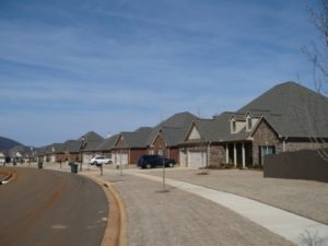
Single-family homes in the Sanctuary Cove subdivision in East Huntsville.
Most of Huntsville’s residential districts are designated for low-density, making single-family homes the majority of the housing stock in the city. Some pockets of residential zoning allow for apartments and townhomes—Jones Valley, Martin-Zierdt, and the Northwest subarea to name a few. Another residential zoning designation—Planned Development-Housing—has been used for master-planned communities like The Ledges and Providence to allow for a set of guidelines specific to that neighborhood.
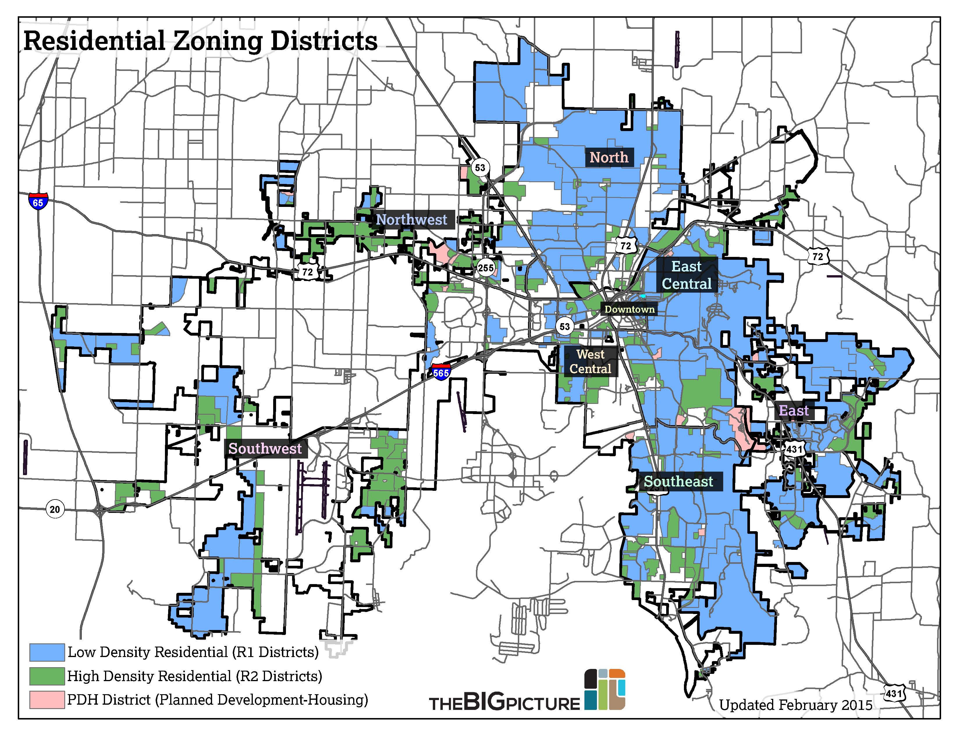
Residential districts in the City of Huntsville
Low Density
- R1- Residential 1
Single-family detached homes, churches, government use - R1A- Residential 1-A
Same uses as R1, smaller minimum lot size - R1B- Residential 1-B
Same uses as R1, even smaller minimum lot size - R1C- Residential 1-C
Same uses as R1, smaller minimum lot size (for historic neighborhoods)
High Density
- R2- Residential 2
R1 plus townhomes and duplexes - R2A- Residential 2-A
Same uses as R2, allows for apartment complexes - R2B- Residential 2-B
R2 plus hotels and office buildings
Planned Development
- PD- Planned Development
A master-planned development of any use - PDH- Planned Development Housing
Same as PD, with housing as primary land use
Other
- RO2- Residential Office 2
Transitional zone for residential areas becoming office districts
Multi-Family Zoning
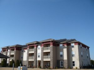
Addison Park Apartments in Northwest Huntsville.
Multi-family residential—apartments and condos—aren’t restricted to high-density residential districts. It’s also allowed on major transportation corridors as well as downtown.
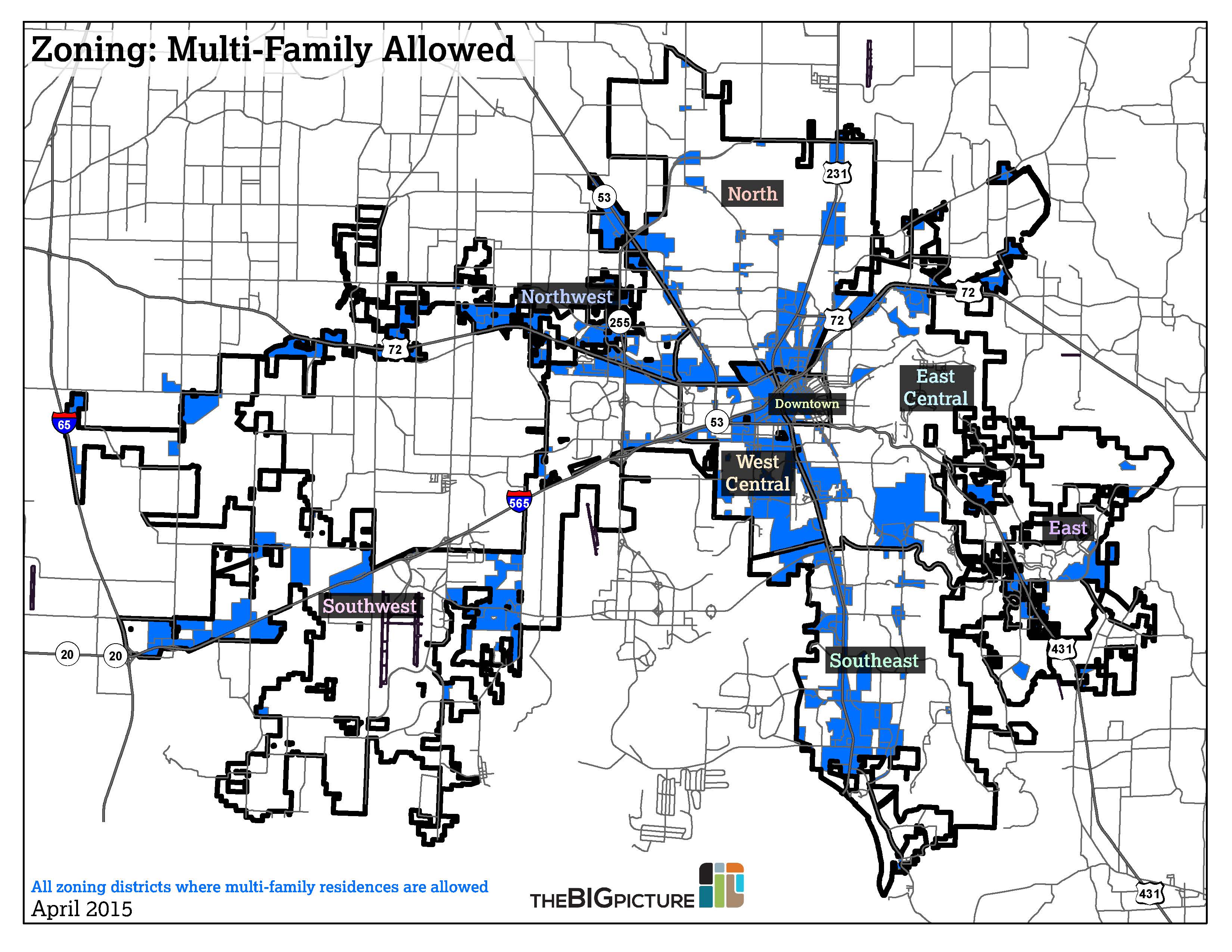
This map shows zoning districts that allow multi-family residential development. This includes, but not limited to:
Residential R-2A, R-2B
Commercial C-1, C-2, C-3
Industrial LI, HI
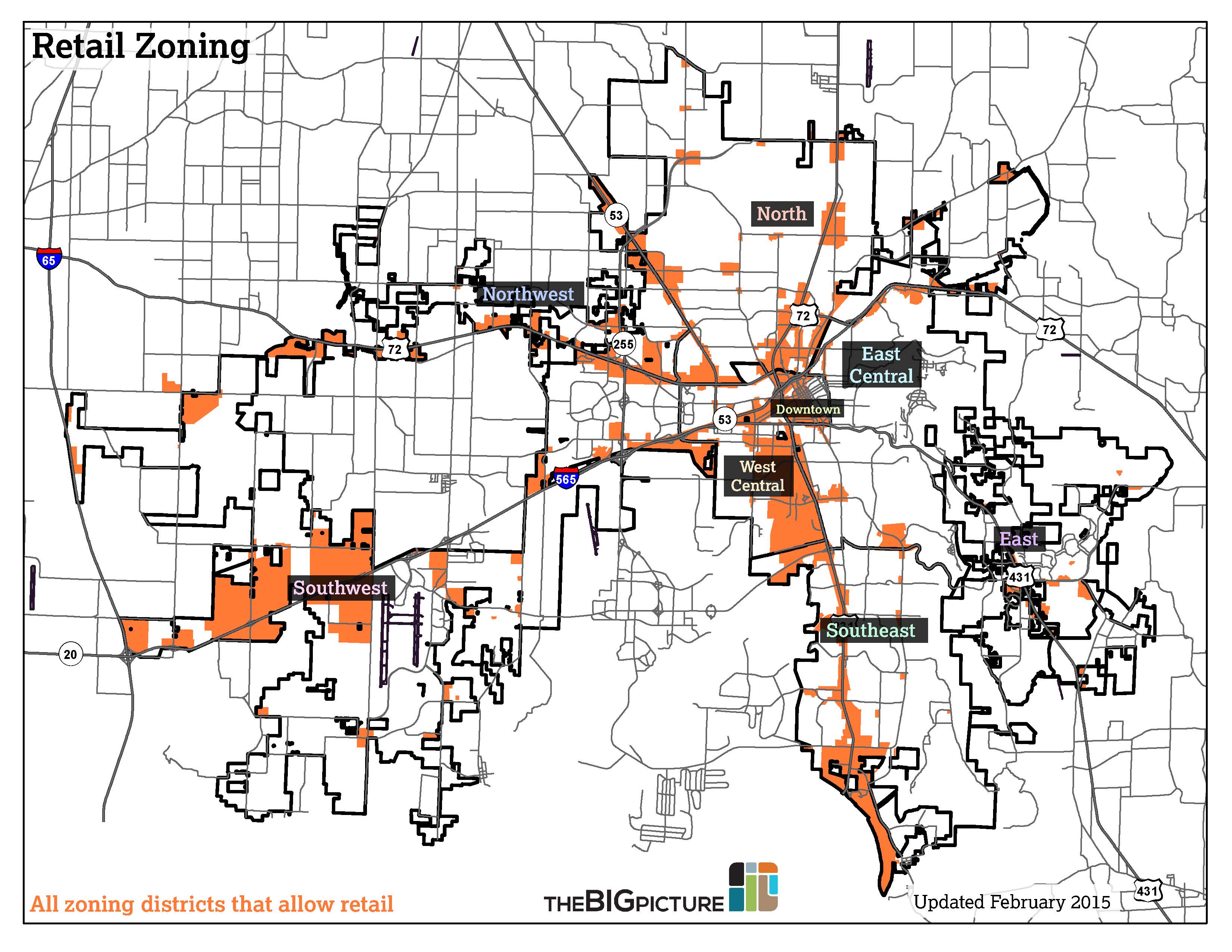
Retail Zoning
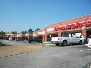
Hunnington Center in Southeast Huntsville.
Zoning districts that allow retail are located along heavily-traveled corridors such as Memorial Parkway, University Drive, and Jordan Lane.
Commercial zoning districts in the City of Huntsville:
- C1- Neighborhood Business C-1
Small shops, restaurants, offices - C2- Neighborhood Business C-2
C-1 with billboards - C3- Central Business District
Downtown businesses and upper-level residences - C4- Highway Commercial
Retail and restaurants catering to a broader region (e.g. big-box stores) - C5- Commercial Recreation
Recreational facilities (amusement parks, campgrounds, golf courses…) - RPC- Research Park Commercial
Retail and services within the Research Park area (e.g. Bridge Street)
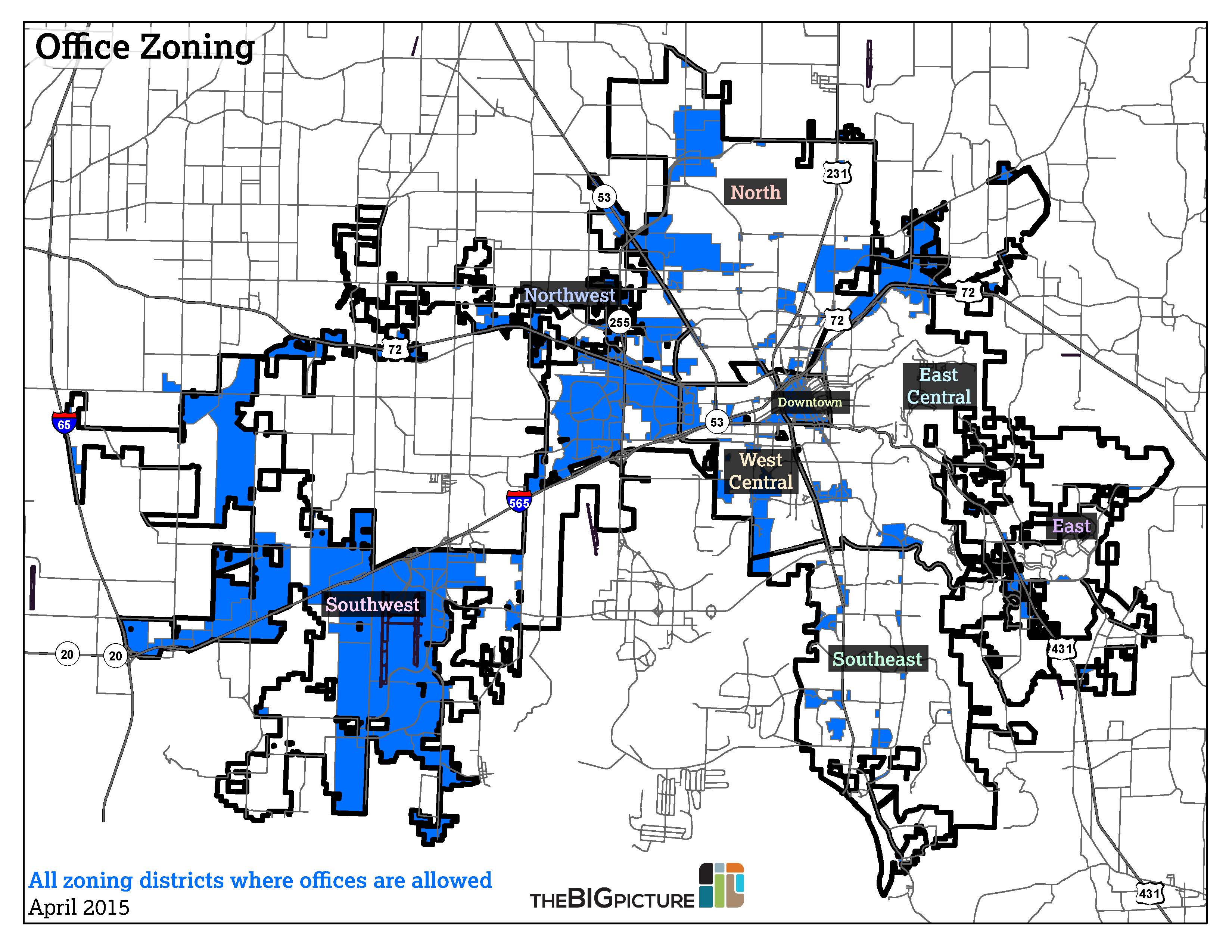
Office Zoning
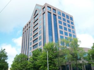
Regions Center in Downtown Huntsville—the tallest office building in the city.
Office districts are located in clusters of high employment and daytime population. There is, however, little co-location with retail and residential. Examples include Cummings Research Park, Jetplex, and Chase Industrial Park.
Office districts in the City of Huntsville:
- M- Medical District
Hospitals, clinics, offices, related businesses - M2- Medical 2 District
Same as M, but with lower density controls - O- Office
Offices and upper-floor residential
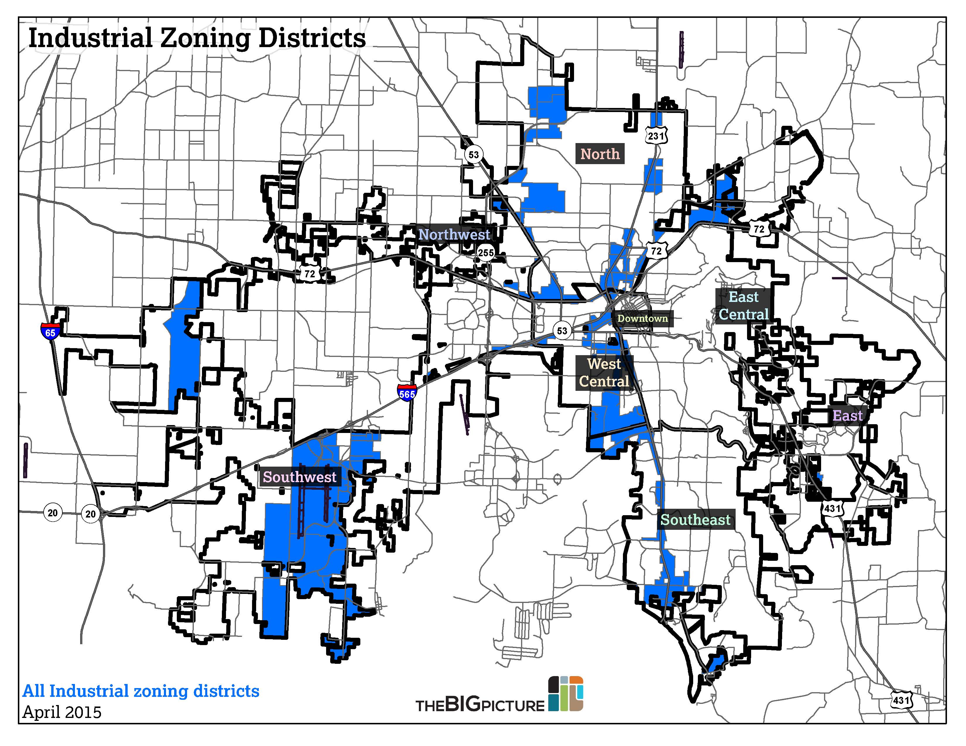
Industrial Zoning
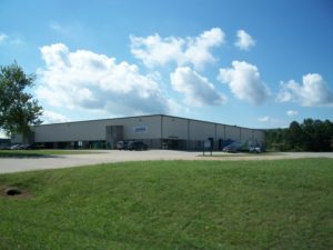
An industrial building in Chase Industrial Park in North Huntsville.
Industrial districts are located in areas with large manufacturing and support facilities. The “Light Industry” zoning district is an interesting exception—much of the property along Memorial Parkway has this designation, allowing for development with little landscaping or buffer requirements.
Industrial districts in the City of Huntsville:
- HI- Heavy Industry
Retail, industrial, large apartment complexes - LI- Light Industry
Same as HI except jails and helipads - IP- Industrial Park
Industrial and office uses only - CIP- Commercial Industrial Park
Retail and light industrial activity; more landscaping, sign restrictions
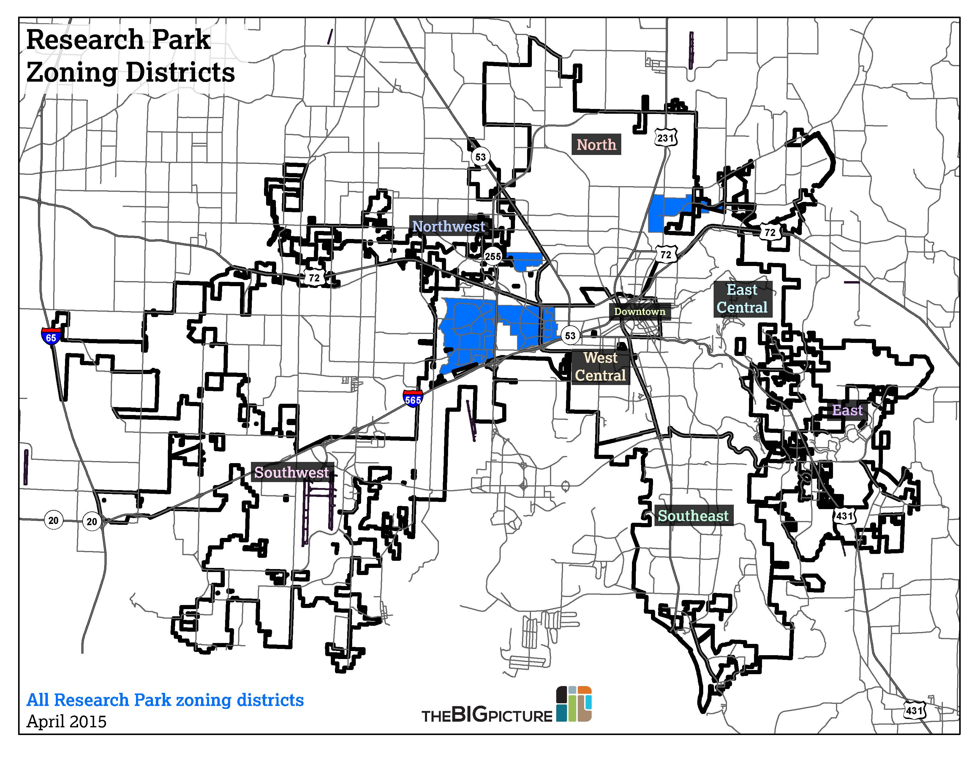
Research Park Zoning
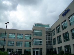
An office building in Cummings Research Park West in Southwest Huntsville.
Research Park districts include not just Cummings Research Park, but Huntsville’s trio of four-year institutions—Alabama A&M, Oakwood, and UAH.
Research Park districts in the City of Huntsville:
- RP- Research Park
Offices, public and educational institutions, agriculture - RPW- Research Park West
Same as RP, but offices restricted to research and development - RPA- Research Park Applications
Allows for manufacturing facilities in Research Park - RPA-2- Research Park Applications 2
Same as RPA, but allows additional manufacturing operations
Find Your Zoning District
Type an address in the box below to find out which existing zoning district it’s located in. (City of Huntsville addresses only. Official zoning maps are available from the City of Huntsville’s GIS division, located at City Hall.)
Huntsville may be a sprawling city as a whole, but it does have pockets of density. In fact, some neighborhoods in the West Central subarea have densities of more than 5,000 people per square mile—comparable to the average density of cities like Pittsburgh and St. Paul, Minnesota.
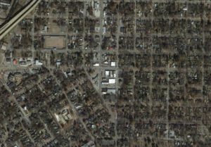 For example, the Five Points neighborhood is pictured. Within this area, there’s a school, parks, shops, restaurants, a grocery store—and a variety of housing stock. The neighborhood was developed in the early 1900s as a “streetcar suburb”—an easily walkable area not designed around the automobile.
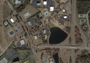 Of course, Five Points isn’t the norm in Huntsville. Much of the city looks like the picture on the left. This is Cummings Research Park West, an office park developed in the 1980s. Office space is the dominant use. Except for a few corporate cafeterias, CRP doesn’t have restaurants; no retail or residential development is allowed within the park. It was designed for driving. And there’s nothing sinister about that—it’s the way office parks were designed in that era.
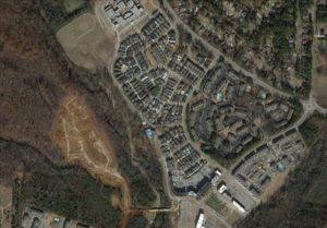 We’re now seeing a movement towards the “traditional” neighborhood design, where not only driving but walking, biking or transit makes transportation more sustainable. Providence, pictured on the right, is located in the Northwest subarea off University Drive, was an early adopter of “Traditional Neighborhood Development”, sometimes referred to as “New Urbanism.”
Will everyone want to live in a “traditional” neighborhood? Of course not. Therefore, it’s important for the city to have a diverse housing stock of various shapes and sizes. We also need to prevent neighborhoods from falling into a cycle of disinvestment. Read more about the BIG Picture’s Neighborhood Revitalization Citizens Academy.
Next, we’ll take a look at the age of housing in some of Huntsville’s neighborhoods. The following images show the age of residential structures in Madison County, based on public property records (select an image from the gallery below).


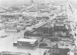
Memorial Parkway and Bob Wallace Ave. after a flood in 1973.
The Federal Emergency Management Agency (FEMA) designates floodway, flood fringe, and floodplain boundaries to determine rates for flood insurance. These areas have special development restrictions that prevent many large-scale projects from occurring without expensive engineering and drainage work. Note: Areas in a floodway or flood fringe have a greater than 0.2 percent chance of flooding any given year (once in 100 years, on average)
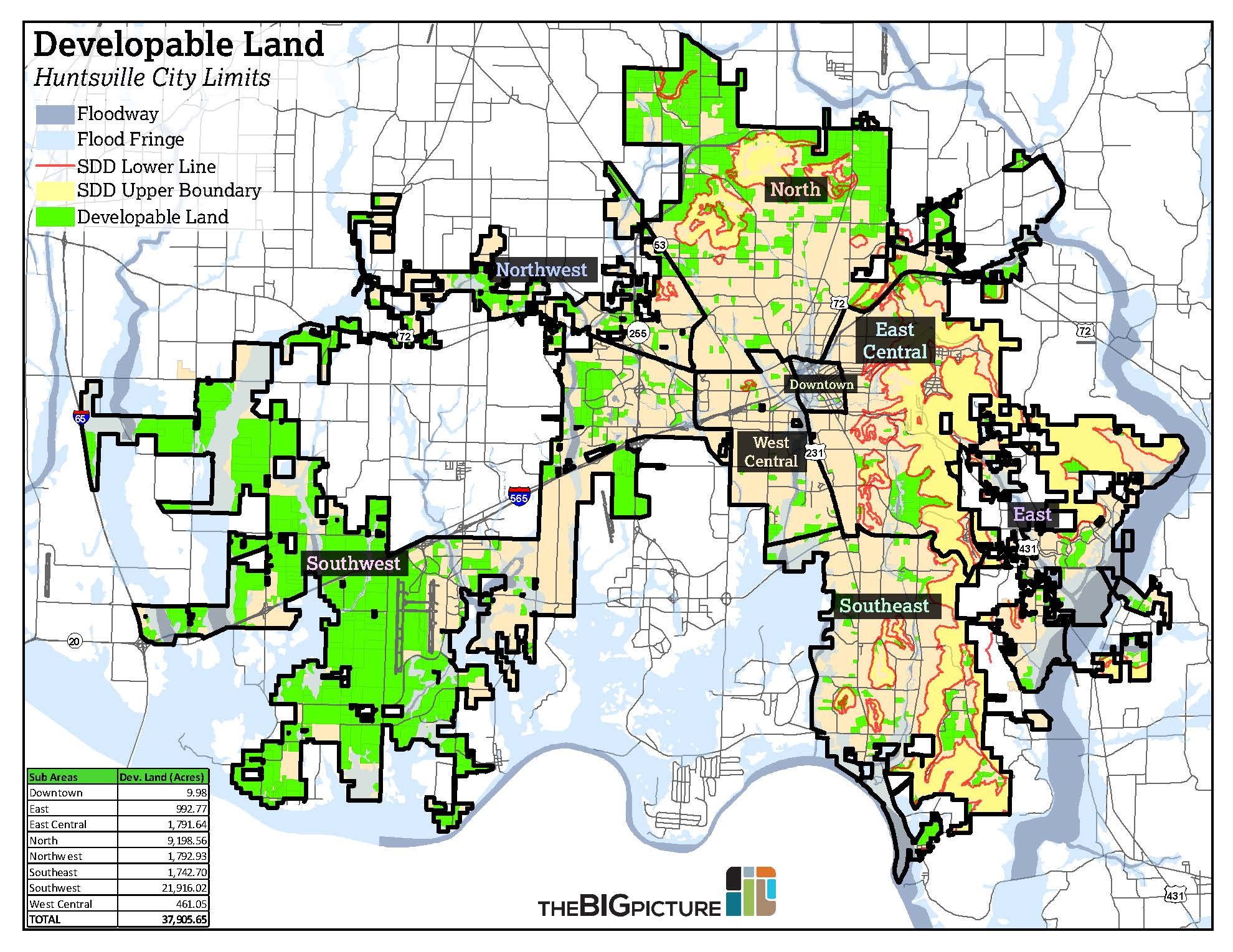
The Slope Development Districts (SDDs) were created in 1996 to restrict development on mountain slopes for two reasons: to preserve the slopes as open land; and to prevent landslides. Specific regulations for the SDDs can be found in the city’s Zoning Ordinance. SDDs are most important in determining developable land in East, East Central, and Southeast Huntsville. Much of the open land in the area is undevelopable in a large scale due to the SDDs.
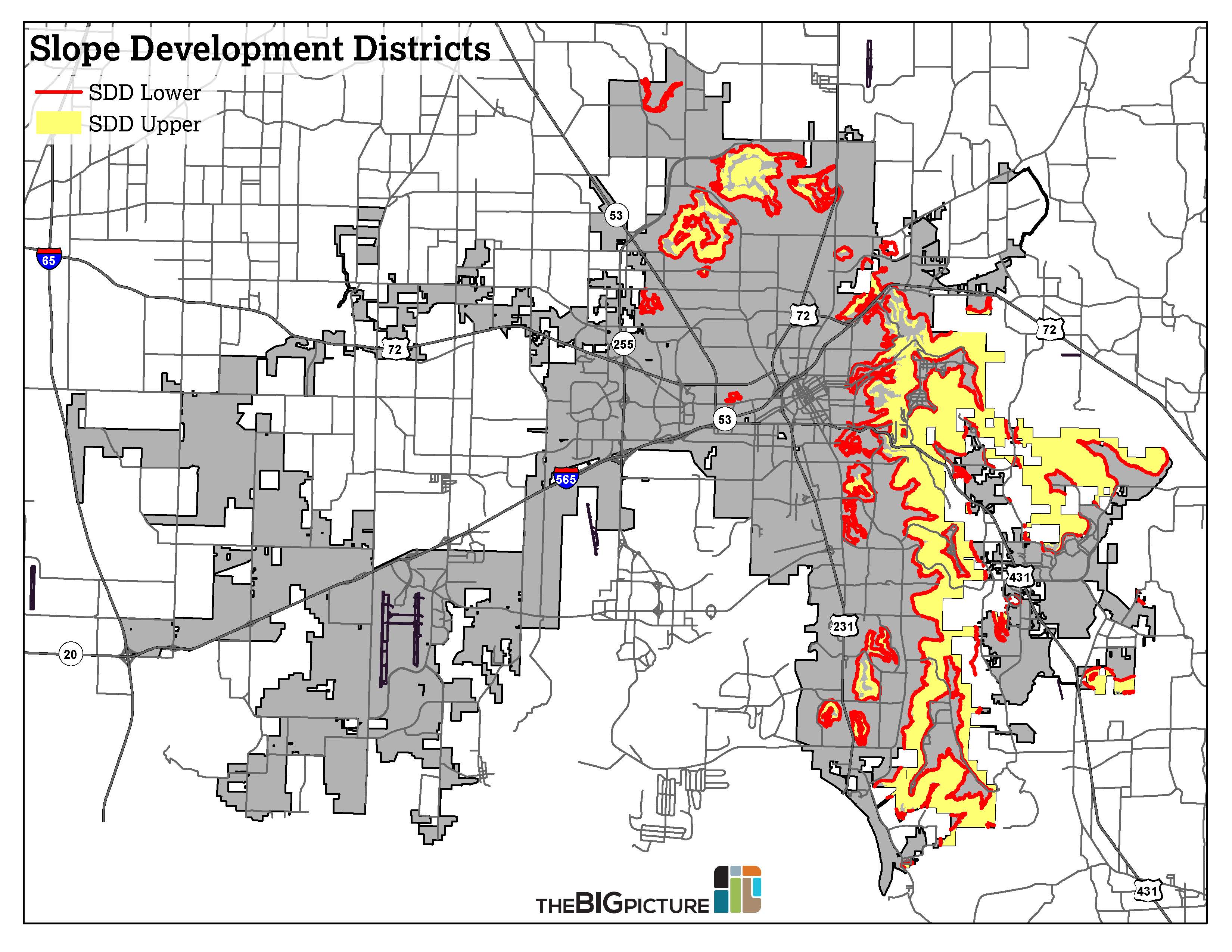
Due to regulatory constraints such as Slope Development Districts and floodplains, the fast-growing East subarea is quickly running out of developable land.
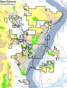
Huntsville has 37,905 acres of developable land in its current city limits– approximately 59 square miles, or about 28 percent of the city’s land area. Much of this land is located in East Limestone and north of Winchester Road. Other large swaths of developable land are located in Research Park West, Redstone Gateway, and Jones Valley.
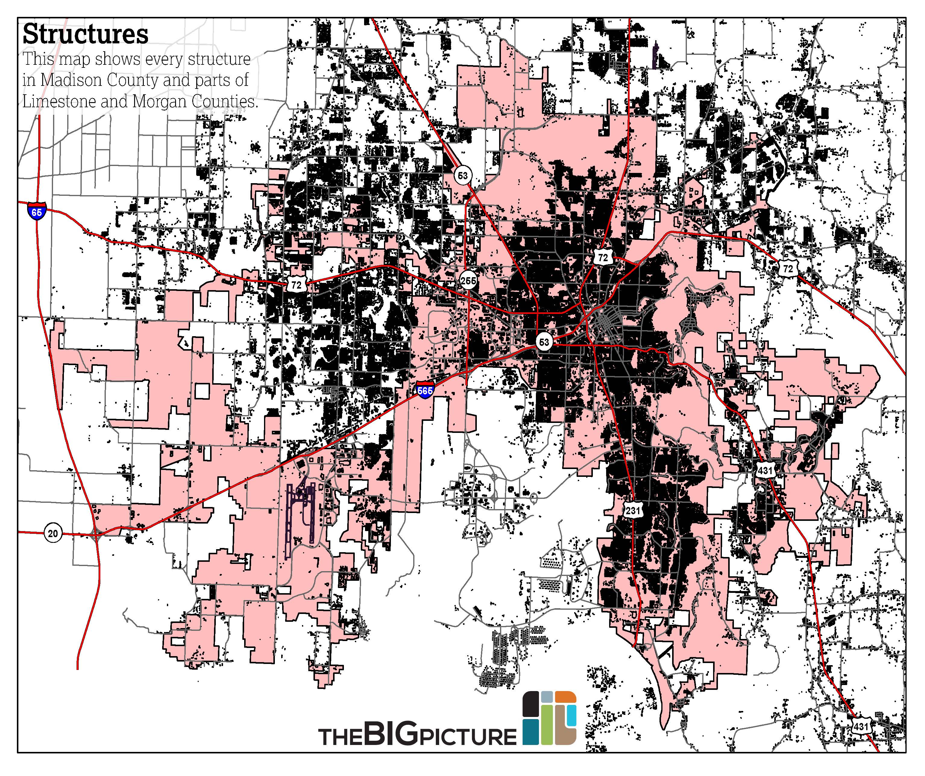
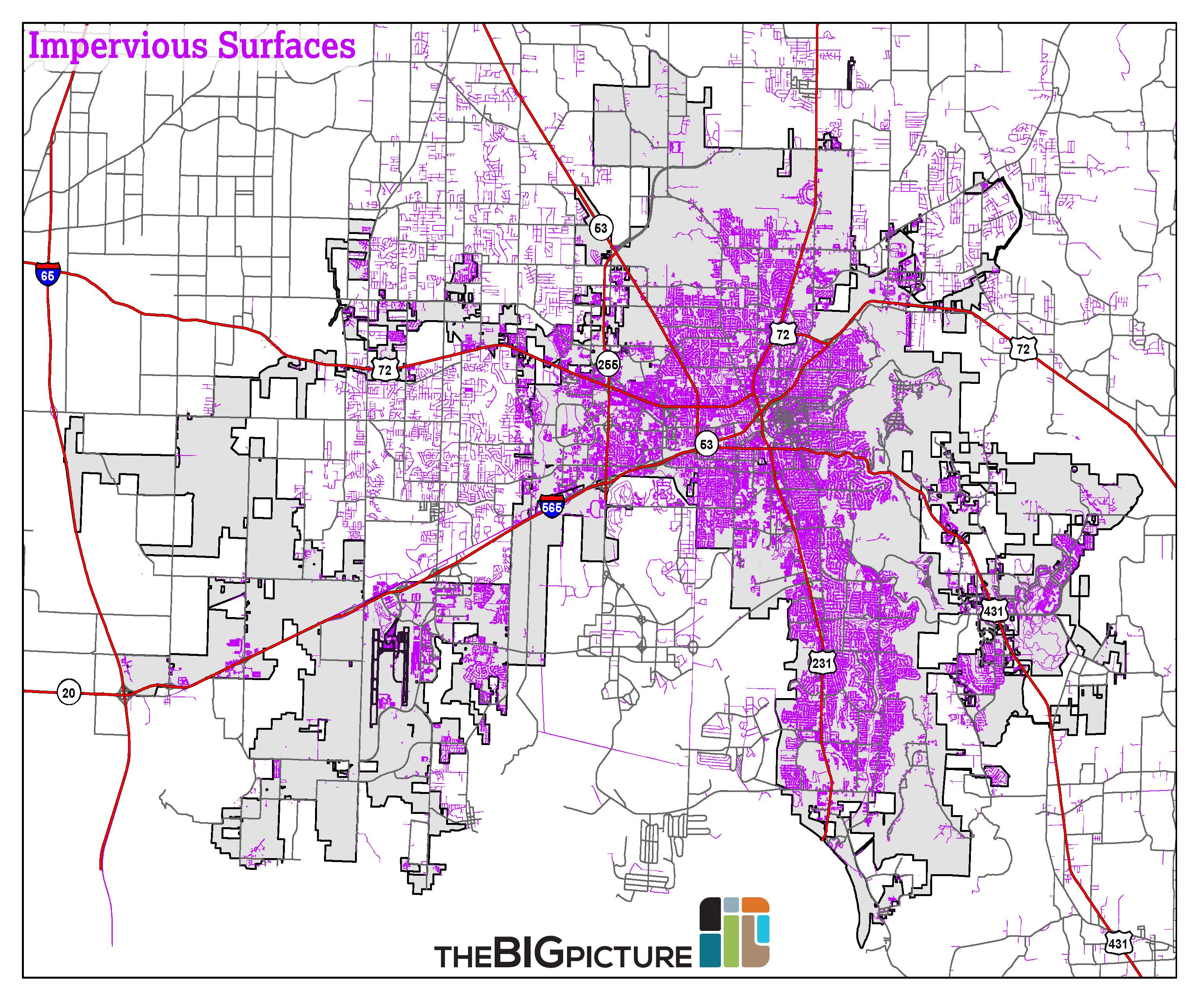
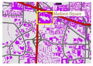 This map shows every road, sidewalk, driveway, and parking lot in Huntsville. In some cases, you can even see individual buildings, outlined by their parking lots. Madison Square Mall can be seen in the image to the right, surrounded by an asphalt parking lot that spans dozens of acres.
Todd Towers in Downtown Huntsville.
The Huntsville Housing Authority has over 1,000 housing units in the city of Huntsville. The largest complexes are located in West Central Huntsville. Other large developments are located in Downtown and North Huntsville, with smaller developments scattered throughout the city. In addition to public housing developments, the map below includes Section 8 housing by subarea.

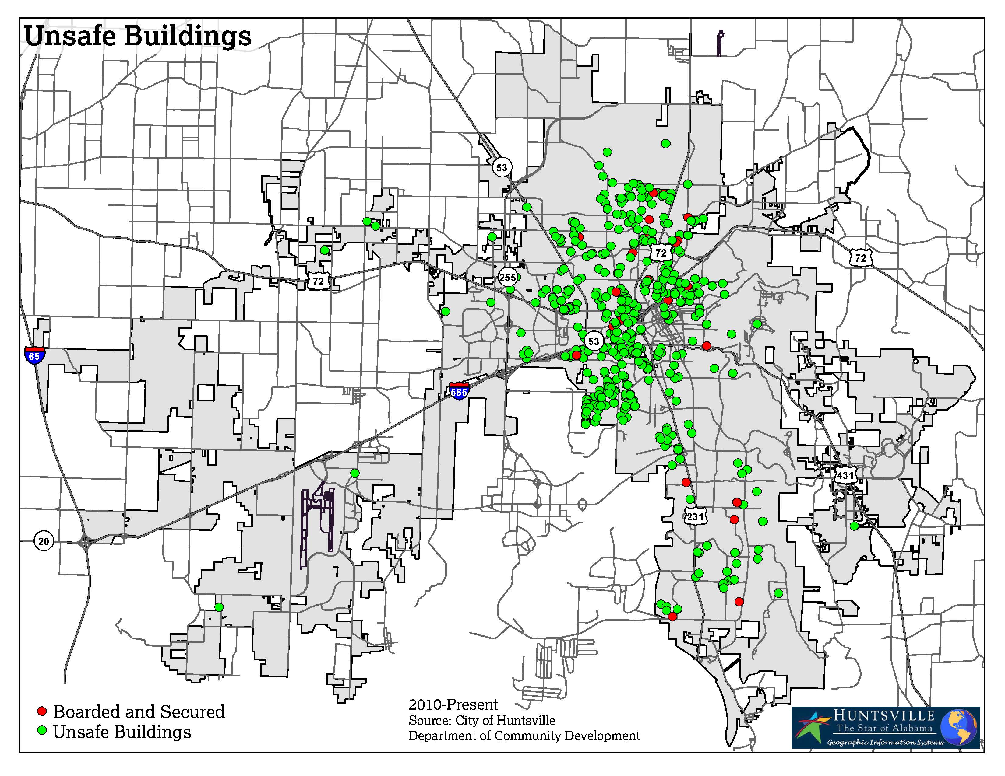
There were a total of 774 buildings classified as “unsafe” by the City of Huntsville Department of Community Development between 2010 and 2013. Of these, 41 were classified “Boarded and Secured.” Every subarea had unsafe buildings during the time period, with the majority concentrated in the North and West Central subareas.
Understanding current land use patterns is crucial in assessing the health and potential of a city’s development. The construction of low-density strip malls surrounded by single-family residential subdivisions was the predominant development pattern in Huntsville and most U.S. cities during the latter half of the 20th Century. However, as demographics change, consumer preferences evolve. Low-density land use patterns, which may have been appropriate in the past, may not be sustainable in the future. Although this issue is being faced by many cities today, it presents a unique challenge in Huntsville, which experienced much of its growth during this period.
Last modified: November 20th, 2018 at 3:00 pm